Riparian Engineering has developed a sea level rise / tidal modelling tool that can predict the impacts of storm surges and sea level rises on the estuarine environment. The model can incorporate LiDAR and existing tidal, flood and storm surge models combined with out water course and flood risk modelling too to determine estuarine inundation and threats to council and private assets. Some people refer to it as the bathtub model but it can be a quick and reliable way for determining estuarine and coastal hazards.
The method can also be applied with remote sensing techniques to map and classify estuarine wetlands, saltmarshes and intertidal areas. We have applied this method to map the geomorphological and floristic boundaries of estuarine wetlands for the entire Gold Coast City Council. These maps will be uploaded shortly once they have been approved by Council.

Morpho-stratigraphic cross section of an estuary showing location of the estuary channel and intertidal areas.
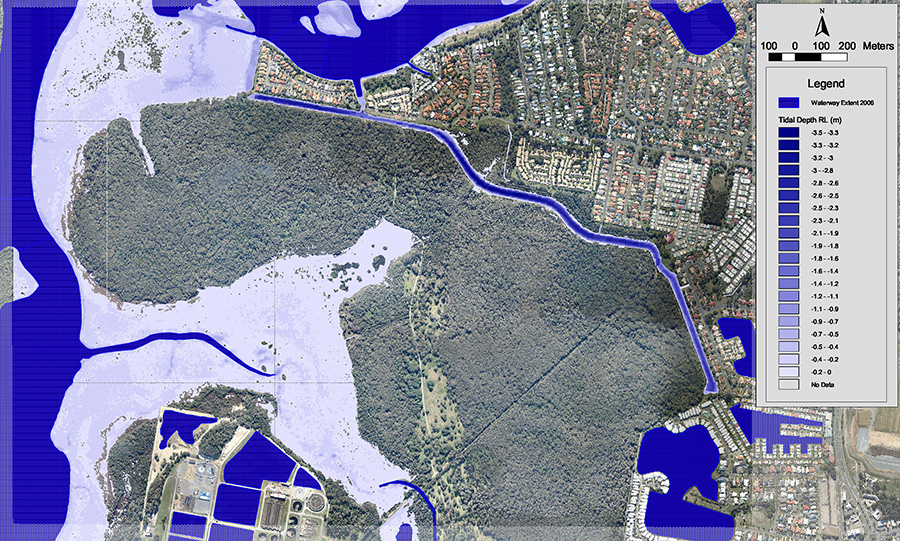
Tidal modelling: the dark blue areas show the tidal channel, the light blue areas show the intertidal area.
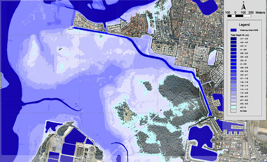
The impacts of 0.8m sea level rise modelling and the impacts on estuarine & terrestrial habitat and on adjacent development.