The riparian zone is the interface between terrestrial and aquatic landscapes and is one of the fifteen terrestrial biomes on earth. Vegetation found on the riparian zone (riverine, estuarine, wetlands) is called riparian vegetation and can be classified into five structural groups (wetland sedges, herbaceous grasses, shrubs, open woodlands, closed woodlands).
Riparian & Coastal Vegetation Assessments:
- Riparian vegetation mapping at both site and regional scales
- Riparian vegetation structure and composition assessments
- Riparian vegetation health assessments
- Riparian vegetation management plans
- Riparian vegetation management specifications (regional & site scale)
- Riparian vegetation restoration plans (site scale)
- Riparian zone delineation and mapping (see water course mapping)
- Remote sensing
- Flood risk assessment and riparian vegetation assessment
- On site riparian vegetation regeneration and restoration
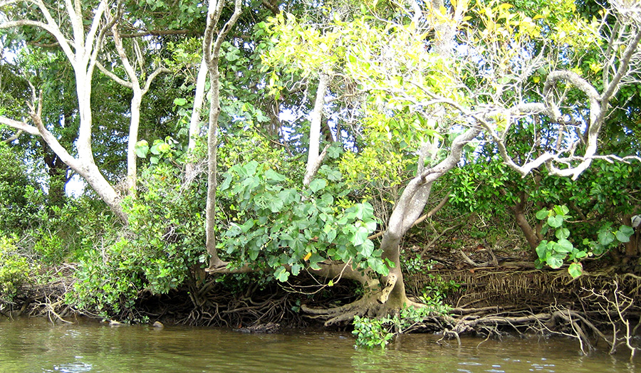
Intact riparian vegetation along a foreshore. Note the association between the native hibiscus and mangroves, which work in association to provide a substrate more conducive to natural vegetation recruitment as well as stabilising the foreshore.
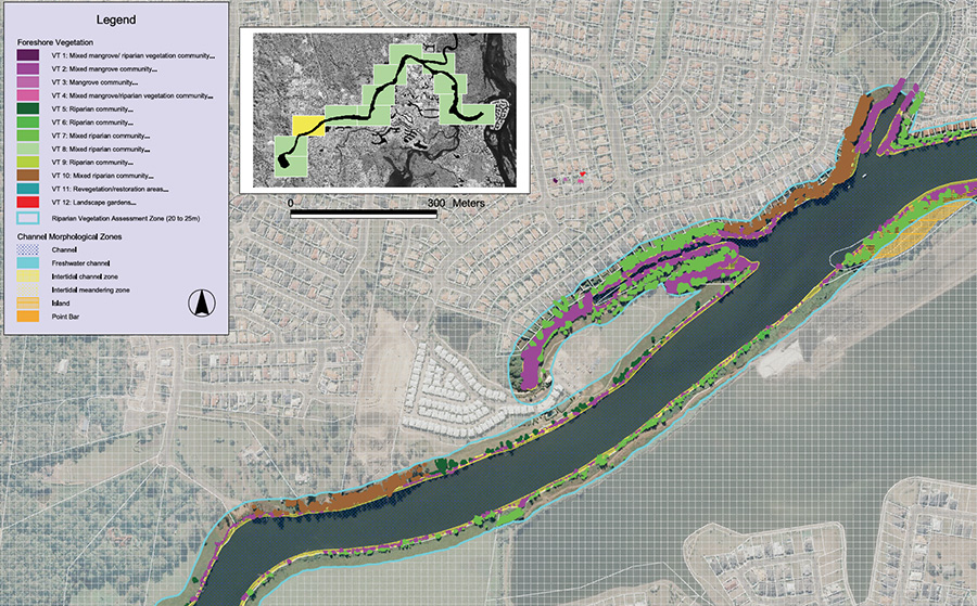
Riparian vegetation type map at 1:5000 scale.
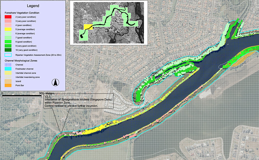
Riparian vegetation condition map with management recommendations at 1:5000 scale.
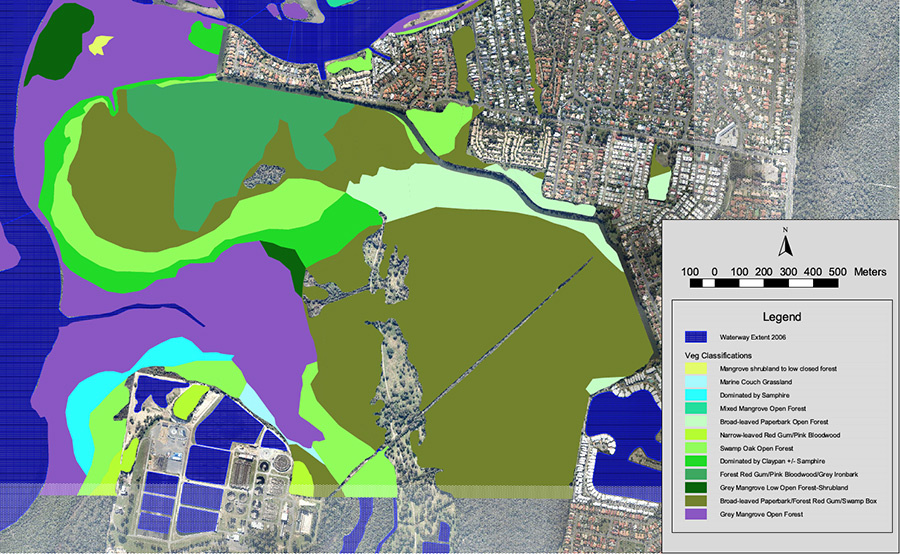
Estuarine vegetation type map.
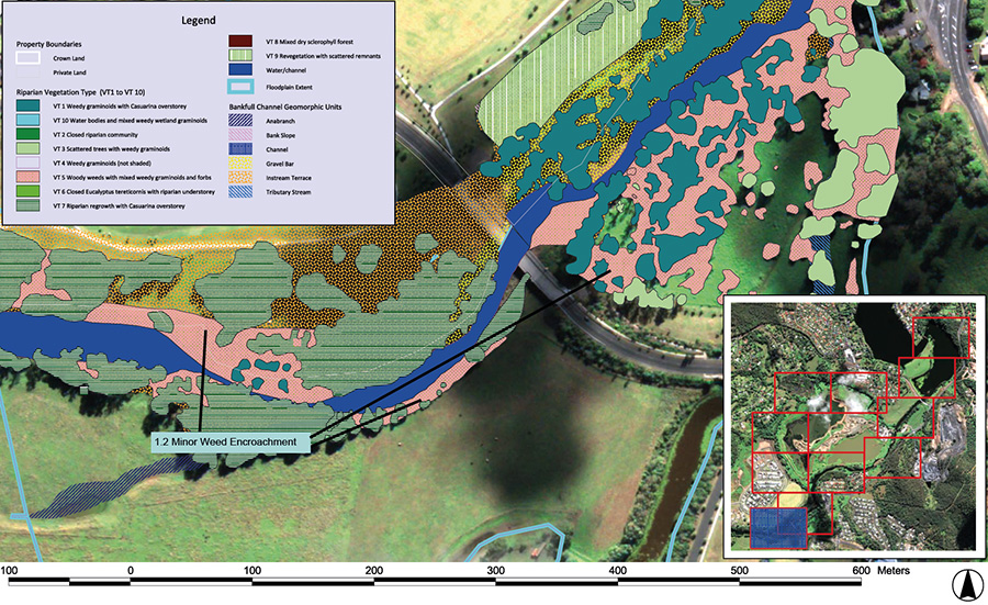 Riparian vegetation type map at 1:1000 scale.
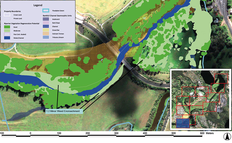 Riparian vegetation condition map at 1:1000 scale.
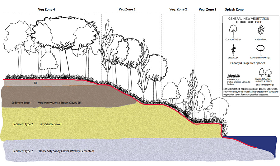 Riparian vegetation site restoration plan (concept plan).
Riparian vegetation site restoration plan.
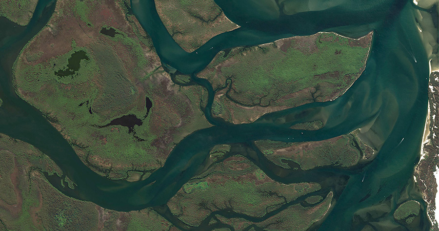
Mangrove and salt marsh vegetation areas (bright green and brown) have formed on thin layer of brown estuarine mud approximately 1m deep that overlain on top of tidal sand deposited in the marine transgression. This type of estuarine landscape provides significant refuge for terrestrial and marine biodiversity. The area also has significant community value, who place great importance on it as an a natural landscape.
